Metro Area Stations |
Largo Town Center Metrorail Station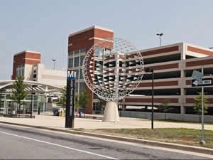
Station Area Vision This station is one of two new stations opening in late 2004. A new plan calls for a lively and vibrant transit center including single-family and multifamily residential, retail, hotel, and office uses. The main focus of this transit area is the Boulevard at the Capital Centre, a high profile, lifestyle center combining retail, dining, and entertainment. With over a halfmillion square feet, this beautifully landscaped outdoor center includes more than 70 national and local stores and a multiscreen movie theatre in a "Main Street" setting. Largo Town Center Metrorail Station
The land uses planned within one-half mile of the Metro station are commercial, office, and retail. The Morgan Boulevard and Largo Town Center Metro Areas Sector Plan is the applicable sector plan for this station. Sites in Public Ownership WMATA owns 22.0 acres including the station and parking area. 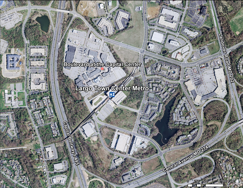 Quick Facts (WMATA Data 2010)
 The Central Avenue-Metro Blue Line Corridor TOD Implementation Project includes two distinct but overlapping areas. The first area consists of properties between the District of Columbia and Daimler Drive included within the Capitol Heights Transit District Overlay, the Addison Road Town Center and Vicinity SMA Development District Overlay, and the proposed Addison Road Regulating Plan. It reflects the program’s emphasis on promoting transit-oriented development, high-quality urban design, and station accessibility around the Capitol Heights and Addison Road-Seat Pleasant Metro Stations while strengthening neighboring residential communities. The second area is broader, extending along Central Avenue from the District of Columbia to the Largo Town Center Metro Station within a half-mile radius of Central Avenue, to allow the program to comprehensively examine the Metro Blue Line corridor, forge a clear marketing and economic development campaign, and support business attraction and retention efforts. The Central Avenue-Metro Blue Line Corridor TOD Implementation Project includes two distinct but overlapping areas. The first area consists of properties between the District of Columbia and Daimler Drive included within the Capitol Heights Transit District Overlay, the Addison Road Town Center and Vicinity SMA Development District Overlay, and the proposed Addison Road Regulating Plan. It reflects the program’s emphasis on promoting transit-oriented development, high-quality urban design, and station accessibility around the Capitol Heights and Addison Road-Seat Pleasant Metro Stations while strengthening neighboring residential communities. The second area is broader, extending along Central Avenue from the District of Columbia to the Largo Town Center Metro Station within a half-mile radius of Central Avenue, to allow the program to comprehensively examine the Metro Blue Line corridor, forge a clear marketing and economic development campaign, and support business attraction and retention efforts.
Subregion 4 (Central Avenue-Metro Blue Line Corridor) TOD Implementation Project  Subregion 4 (Central Avenue-Metro Blue Line Corridor) TOD Implementation Project
The Subregion 4 Transit-Oriented Development Implementation Project will put into effect the vision and goals for the Central Avenue corridor as presented in the recently approved 2010 Subregion 4 Master Plan and Sectional Map Amendment and will advance the recommendations of the 2008 Capitol Heights Transit District Development Plan and Transit District Overlay Zoning Amendment. These plans envision mixed-use, transit-oriented development and promote housing and neighborhood conservation, public facility and infrastructure improvements, and commercial revitalization. In 2010-2011, the project will focus on Capitol Heights and Addison Road Seat Pleasant Metro Stations and during 2011-2012 the project will concentrate on Largo Town Center & Morgan Boulevard Metro Stations. Read more about this plan 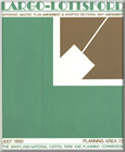
Largo-Lottsford Approved Master Plan and Adopted Sectional Map Amendment (July 1990)
|

