Cheverly Metrorail Station
Cheverly Metrorail Station
The land uses planned within one-half mile of the Metro station are service commercial. The Bladensburg-New Carrollton and Vicinity Master Plan (1994) is the applicable plan for the area north of the station and the Landover and Vicinity Master Plan (1993) is the applicable plan for the area south of the Metro station. Sites in Public Ownership WMATA owns 30.2 acres including the station and parking area. 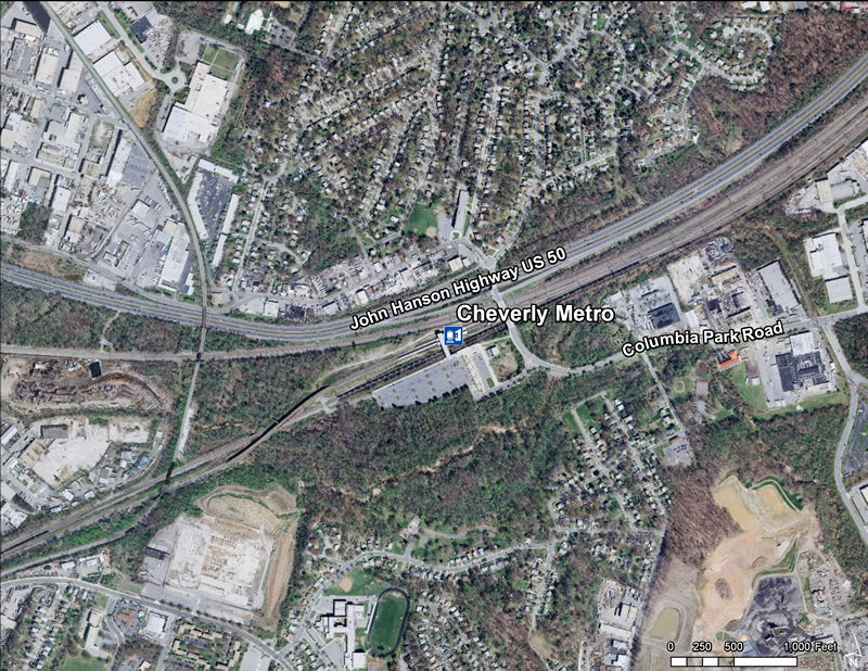 Quick Facts (WMATA Data 2010)

Tuxedo Road/Arbor Street/Cheverly Metro Area Approved Sector Plan and Sectional Map Amendment (April 2005) This document contains text and maps of the Approved Sector Plan and Sectional Map Amendment for the Tuxedo Road/Arbor Street/Cheverly Metro Area. The plan amends portions of the 1994 Approved Master Plan and Sectional Map Amendment for Bladensburg?New Carrollton and Vicinity (Planning Area 69) and the 1993 Approved Master Plan and Sectional Map Amendment for Landover and Vicinity (Planning Area 72). This document describes existing plans and policies for the area and analyzes land use, zoning, transportation, environment, urban design, and public facilities. It proposes flexible land use and zoning regulations that encourage revitalization and redevelopment of the Tuxedo Road industrial area and Arbor Street commercial area and promotes transit-oriented development in the vicinity of the Cheverly Metro Station. A proposed Development District Overlay Zone (DDOZ) containing design standards and a table of uses are included to help facilitate the implementation of the plan's land use and community character recommendations. |
