Metro Area Stations |
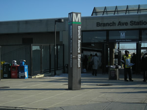
Branch Avenue Metrorail Station
Station Area Vision Mixed-use opportunities abound at this Metropolitan Center where intensity and a diversity of uses are strongly encouraged by the approved plan. Appropriate zoning and guidelines are in place to ensure well-designed development. Future development includes single-family townhomes, luxury apartments, office and retail uses. Branch Avenue is one of three stations in Prince George’s County designated a priority TOD site by Maryland Governor Martin O’Malley in June 2010. Branch Avenue Metrorail Station
The land uses planned within one-half mile of the Metro station are office, retail, and medium- to high-density residential. The Heights and Vicinity Master Plan (2000) is the applicable master plan for this Metro station area. Sites in Public Ownership WMATA owns 37.9 acres including the station and parking area. 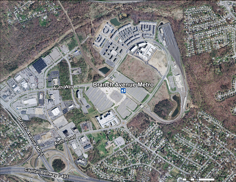 Quick Facts (WMATA Data 2010)
 Branch Avenue is the last station on the southern Green Line, located just north of the Capital Beltway. This site has exceptional regional access but is also a district apart, separated from surrounding areas by wetlands and major roadways. The district is still only partially developed and has
potential to become a major employment center complemented by a mix of urban-style residential and retail development. The county
has designated the area as a metropolitan center, so expectations are high for future development. Recent development north of the
station includes hundreds of new apartments and condominiums and new retail space in mixed-use buildings. A large office
development is proposed for the site immediately east of the station. Like Naylor Road, the Branch Avenue station area is a
state–designated TOD site. Branch Avenue is the last station on the southern Green Line, located just north of the Capital Beltway. This site has exceptional regional access but is also a district apart, separated from surrounding areas by wetlands and major roadways. The district is still only partially developed and has
potential to become a major employment center complemented by a mix of urban-style residential and retail development. The county
has designated the area as a metropolitan center, so expectations are high for future development. Recent development north of the
station includes hundreds of new apartments and condominiums and new retail space in mixed-use buildings. A large office
development is proposed for the site immediately east of the station. Like Naylor Road, the Branch Avenue station area is a
state–designated TOD site.
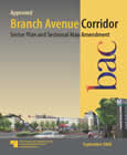
Approved Branch Avenue Corridor Sector Plan and Sectional Map Amendment (September 2008) The Approved Branch Avenue Corridor Sector Plan and Sectional Map Amendment comprises text, maps, illustrations, and pictures. The sector plan amends portions of the 2000 Approved Master Plan and Sectional Map Amendment for the Heights and Vicinity (Planning Area 76A) and the 2002 Prince George's County Approved General Plan. Developed with broad public participation, this document presents background information, the vision for the area, and a discussion of the five elements that frame the vision-Land Use and Economic Development, Design and Appearance, Infrastructure to Support the Plan, Quality of Life, and Community Involvement. The plan recommends the designation of the Naylor Road Metro Station as a Regional Center with a mixeduse, high-density residential/office/retail land use classification, and the Iverson-Marlow Heights Mixed-Use Center as a node on the Branch Avenue Corridor with a mixed-use, medium-density residential/office/ retail land use classification. The plan contains policies and strategies for land use, economic development, urban design, parks and recreation, transportation systems (including roadways, transit, bicycle, pedestrian, and trail facilities), revitalization, public safety, and community involvement. The overall objective of these policies and strategies is to revitalize and redevelop the sector plan area, thereby improving its visual appeal and providing pedestrian- and transit-oriented, mixed-use development that will create a positive sense of place and attract new residents, quality retail, and jobs while preserving and strengthening the existing residential neighborhoods. The sectional map amendment (SMA) contains zoning changes to allow implementation of the plan vision and the land use concepts in the sector plan. The Metro Green Line Transit-Oriented Development Corridor Action Plan
The Prince George’s County Planning Department of The Maryland–National Capital Park and Planning Commission (M-NCPPC or the Commission) is a recipient of a 2010 US Department of Housing and Urban Development (HUD) Challenge Planning Grant. The planning grant is to fund preparation of a comprehensive transit-oriented development action plan for the corridor that encompasses the last four Metro stations on the southern part of the Green Line in Prince George’s County, Maryland. The purpose of the planning project is to recommend policies, strategies, and an economic develoment program to stimulate growth at the four stations according to a well defined urban development plan. Read more about this plan. |

